
Pakistan’s remote sensing satellite enters orbit
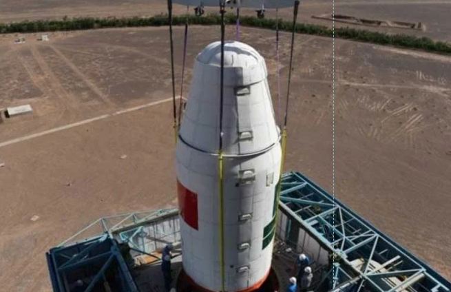
ISLAMABAD, AUG 16: Pakistan’s modern remote sensing satellite has successfully entered orbit and established stable contact with ground stations.
According to a statement from the Space and Upper Atmosphere Research Commission (Suparco), the satellite has begun transmitting high-resolution images of Earth, with potential applications in urban planning and infrastructure development.
The technology is expected to improve the country’s capacity to monitor natural disasters, including floods, earthquakes and landslides, enabling faster and more effective relief operations.
The Suparco said that the satellite would support environmental monitoring by tracking glacial melt and deforestation, while also assisting the agricultural sector through crop mapping and more efficient use of water resources. These capabilities are expected to enhance food security and agricultural output.
Moreover, the satellite will play a role in identifying geological risks and mapping networks along routes linked to China–Pakistan Economic Corridor (CPEC) projects.
Related News

Dar updates Türkiye’s Fidan on Islamabad ceasefire talks
ISLAMABAD, APR 12 /DNA/ – Deputy Prime Minister/Foreign Minister Senator Mohammad Ishaq Dar @MIshaqDar50 spokeRead More

Dar briefs Saudi FM on Islamabad ceasefire push
ISLAMABAD, APR 12 /DNA/ – Deputy Prime Minister/Foreign Minister Senator Mohammad Ishaq Dar @MIshaqDar50 spokeRead More
Comments are Closed